Last winter was one of the warmest in our history, so even if we have a normal heating season in the year ahead, it will be significantly colder than this last one. In fact, early forecasters are indicating a cold winter is ahead. Why? El Niño officially came to an end in early June, and experts are calling for a La Niña to develop in its footsteps.
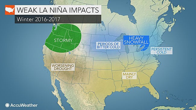
La Niña is the counter to El Niño and can mean very different weather patterns as a result of shifts in the jet stream brought on by changing surface water temperatures. Forecasters say that the La Niña this year will be weak, but could still result in:
- An uptick in tropical storm activity in the Atlantic Ocean through the late Fall. We could see an active hurricane season which runs roughly August through early November.
- A warm Fall. We could see a rather warm Fall through much of the United States. Don’t put away your air conditioning after the first cool nights in September.
- La Niña could mean more snow and cold in the Northeast this coming winter. Maybe not record breaking, but a real winter could be coming our way
- Most of the large snowfalls will come from coastal storms, which may churn to the south of us and hit Washington DC, NYC, and Boston. In our area, we are likely to see average to slightly higher than average snowfall totals.
- The Northern Rockies and Mid-West could experience bitter cold. If they do, we could see propane supply tighten and propane prices could be affected.

Make no mistake! Winter is around the corner. I hope everyone has the opportunity to soak in some sunshine and enjoy the fruits of summer while it lasts.
